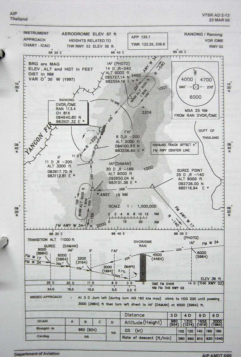
| Name: Ranong Airport - VTSR |
| Coordinates: 09*46.6' N x
098*35.1' E |
| Frequency: 125.1 approach // 122.25 tower |
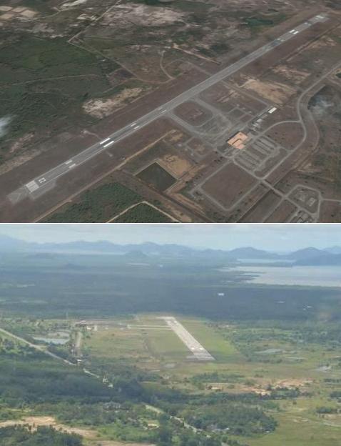
| Runway Heading: 02/20 |
| Length: 2,000 meters |
| Surface: tarmac |
| Slope: none |
| Elevation: 47' |
| Obstructions: n/a |
| Location: 24km North of town |
| Activities: |
| Contact Information: 077 821799 |
| Other links: For additional information: DOA
Aeronautical Information Service, Tung Mahamek, Bangkok 10120, Thailand --
tel: 02 256 0922 // 02 286 0922 // fax: 02 287 4060 // AFTN: VTBAYOYX. |
| Map of Airstrip:
http://www.aisthai.go.th/webais/pdf/AERONAUTICALCHARTS/VTSR.pdf |