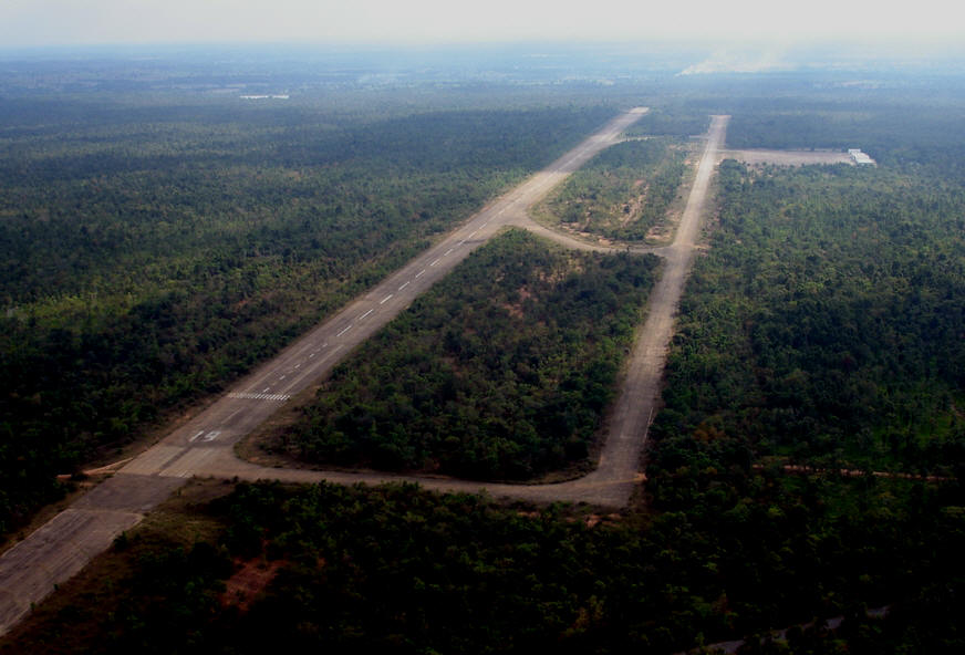
| Name: Nam Phong Airport |
| Coordinates: 16*39' N x
102*58' E |
| Frequency: |
| Runway Heading: 01/19 |
| Length: 10,000' (x 150'
wide) |
| Surface: Tarmac |
| Slope: none |
| Elevation: 750' |
| Obstructions: n/a |
| Location: |
| Activities: Military /
Nam Phong was used as the initial refugee camp for 11,000 of the folks from
Laos in 1975. Les flew one of the CASI C-46s on the air evac from 20A (Long
Tien) on 12-14 May 1975. |
| Contact Information: |
| Other links: For additional information: DOA
Aeronautical Information Service, Tung Mahamek, Bangkok 10120, Thailand --
tel: 02 256 0922 // 02 286 0922 // fax: 02 287 4060 // AFTN: VTBAYOYX. |
| Map of Airstrip: |
|