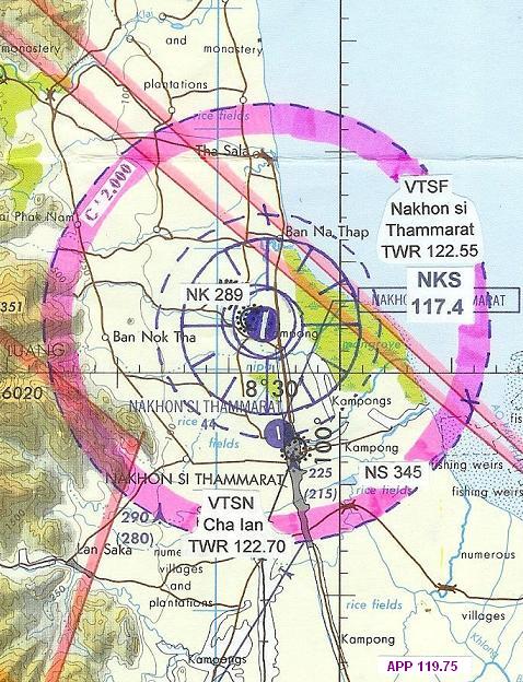
| Name: Nakhon Si Thammarat Airport - VTSF |
| Coordinates: 08*32.6' N x
099*56.6' E |
| Frequency: 129.6 approach // 122.55 tower |
| Runway Heading: 01/19 |
| Length: 2,100 meters |
| Surface: concrete |
| Slope: none |
| Elevation: 13' |
| Obstructions: n/a |
| Location: 10km North of town. |
| Activities: |
| Contact Information: 075 369540 // 369541 |
| Other links: For additional information: DOA
Aeronautical Information Service, Tung Mahamek, Bangkok 10120, Thailand --
tel: 02 256 0922 // 02 286 0922 // fax: 02 287 4060 // AFTN: VTBAYOYX. |
| Map of Airstrip:
http://www.aisthai.go.th/webais/pdf/AERONAUTICALCHARTS/VTSF.pdf |