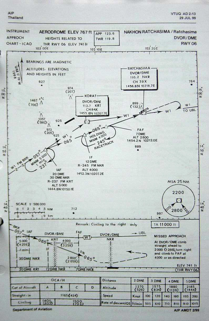
| Name: Nakhon Ratchasima Airport - VTUQ |
| Coordinates: 14*56.9' N x
102*18.7' E |
| Frequency: 134.1 approach // 119.8 tower |
| Runway Heading: 06/24 |
| Length: 2,100 meters (45 meters wide) |
| Surface: tarmac |
| Slope: none |
| Elevation: 765' |
| Obstructions: n/a |
| Location: 26km East of the
City. |
| Activities: Civilian |
| Contact Information: 044 255899 // 259543. |
| Other links: For additional information: DOA
Aeronautical Information Service, Tung Mahamek, Bangkok 10120, Thailand --
tel: 02 256 0922 // 02 286 0922 // fax: 02 287 4060 // AFTN: VTBAYOYX. |
| Map of Airstrip:
http://www.aisthai.go.th/webais/pdf/AERONAUTICALCHARTS/VTUQ.pdf |