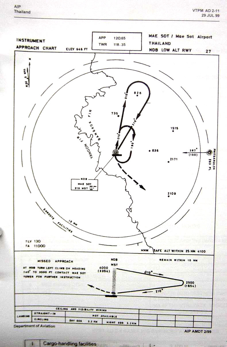
| Name: Mae Sot Airport - VTPM |
| Coordinates: 16*42' N x
098*32.6' E |
| Frequency: 120.65 approach // 118.35 tower |
| Runway Heading: 09/27 |
| Length: 1,500 meters |
| Surface: tarmac |
| Slope: none |
| Elevation: 689' |
| Obstructions: n/a |
| Location: 5km West of town // very close to
Burma border (caution flying near river) |
| Activities: |
| Contact Information:
0818891204 (tower) // 055 631620
/ possible: 0818891204. |
| Other links: For additional information: DOA
Aeronautical Information Service, Tung Mahamek, Bangkok 10120, Thailand --
tel: 02 256 0922 // 02 286 0922 // fax: 02 287 4060 // AFTN: VTBAYOYX. |
| Map of Airstrip:
http://www.aisthai.go.th/webais/pdf/AERONAUTICALCHARTS/VTPM.pdf |