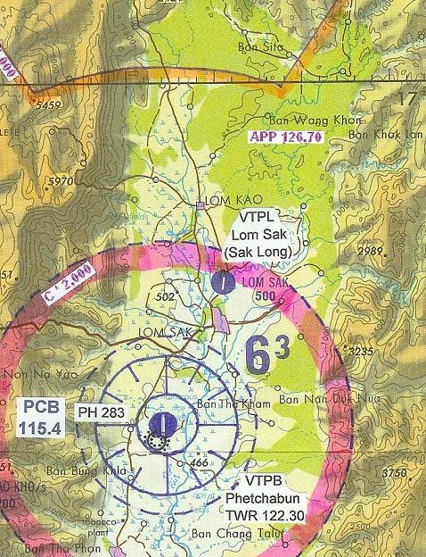
| Name: Lom Sak Airport - VTPL |
| Coordinates: 16*49' N x
101*15' E |
| Frequency: 123.45 (unofficial: pilot to
pilot) // Oscar Control: 127.0 |
| Runway Heading: 18/36 |
| Length: 1,000 meter (unconfirmed)
|
| Surface: asphalt (unconfirmed)
|
| Slope: none |
| Elevation: 500' |
| Obstructions: unknown |
| Location: North side of Petchaboon valley
|
| Activities: |
| Contact Information: Supervising Authority:
Royal Thai Airforce. |
| Other links: |
| Map of Airstrip: |