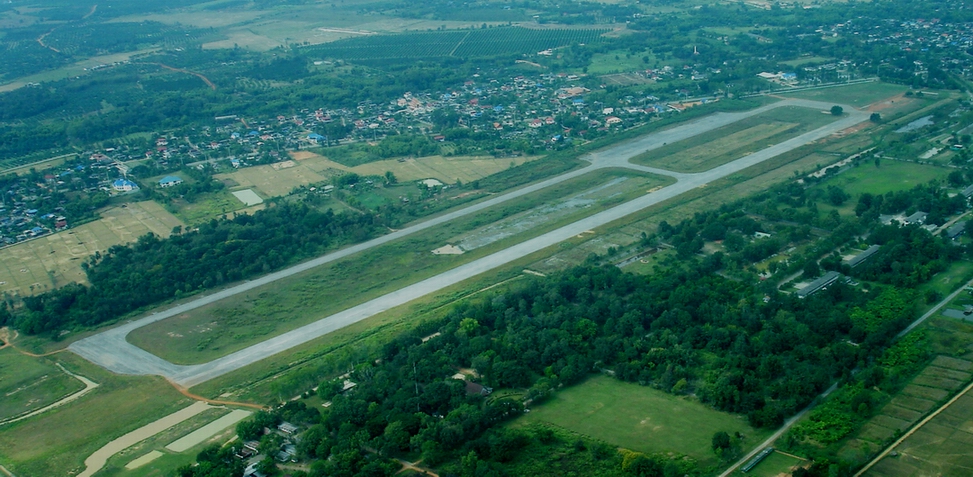
| Name: Chiang Kham Airport -
VTCB |
| Coordinates: 19*30' N x
100*17' E |
| Frequency: |
| Runway Heading: 18/36 |
| Length: 1,400 meters
(unconfirmed) |
| Surface: tarmac |
| Slope: none |
| Elevation: 1,275' |
| Obstructions: n/a |
| Location: Southeast of Chiang Rai |
| Activities: Unused for almost 30 years.
First listed in 1969 in the Air America Site book. Swampy ground in the
center of airport. |
| Contact Information: Royal
Thai Army. |
| Other links: For additional information: DOA
Aeronautical Information Service, Tung Mahamek, Bangkok 10120, Thailand --
tel: 02 256 0922 // 02 286 0922 // fax: 02 287 4060 // AFTN: VTBAYOYX. |
| Map of Airstrip: |