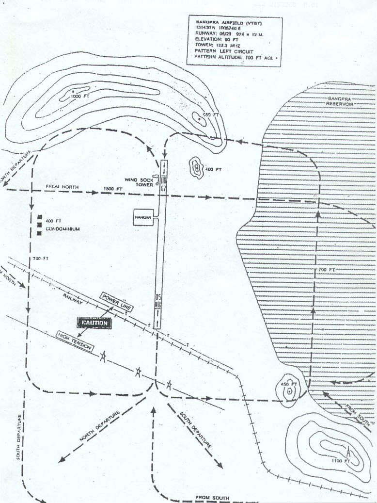
| Name: Bang Phra Airport - VTBT |
| Coordinates:
13*14'N x 100*57.5'E |
| Frequency: 122.3 |
| Runway Heading: 05/23 |
| Length:
924 meters (15 m wide) |
| Surface: tarmac (max
takeoff weight 5,700kg) |
| Slope: 1.25 degrees downslope when taking off
Runway 23. |
| Elevation: 90' |
| Obstructions: mountain on Northeast end //
High-tension wires on Southwest end |
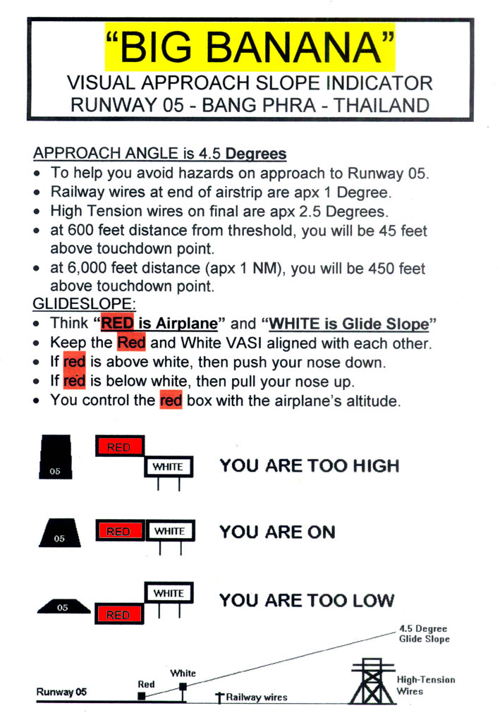
| Runway 05 VASI: visual
approach slope indicator (4.5 degree approach angle) located on right hand
side of Runway 05. One red and One white marker. Line up the markers
to follow 4.5 degree approach slope and remain clear of High-tension wires
and telephone wires. VIEW DIAGRAM OF RUNWAY 05
VASI |
| Location: 40nm Southeast of
Bangkok // North of U-Tapao and Pattaya |
| Activities: IAOPA representative, Flying Club (40 planes +
300 members), Flying Instruction, Validate Foreign Licenses, Aircraft
Maintenance, Clubhouse with restaurant (open weekends), 2 guestrooms TURN
& SLIP INN |
|
 NEW
RESTAURANT -- Gae and Gop
have opened a new restaurant at TFC. They welcome you to visit on the
weekends, and if you want to organize a function during the week which
requires their culinary expertise, then you are welcome to call them and
speak Thai with them -- 0810498904. (Dec 2008) NEW
RESTAURANT -- Gae and Gop
have opened a new restaurant at TFC. They welcome you to visit on the
weekends, and if you want to organize a function during the week which
requires their culinary expertise, then you are welcome to call them and
speak Thai with them -- 0810498904. (Dec 2008) |
| |
| Contact Information: 038 777348 // info@thaiflyingclub.com
|
| Operation Hours: 9am -
5:30pm (closed holidays)
|
| Other links: www.thaiflyingclub.com
|
| Airport Map: Chonburi Area Map, Airstrip
Photograph, Road Map and Approach Chart below: |
 NEW
RESTAURANT -- Gae and Gop
have opened a new restaurant at TFC. They welcome you to visit on the
weekends, and if you want to organize a function during the week which
requires their culinary expertise, then you are welcome to call them and
speak Thai with them -- 0810498904. (Dec 2008)
NEW
RESTAURANT -- Gae and Gop
have opened a new restaurant at TFC. They welcome you to visit on the
weekends, and if you want to organize a function during the week which
requires their culinary expertise, then you are welcome to call them and
speak Thai with them -- 0810498904. (Dec 2008)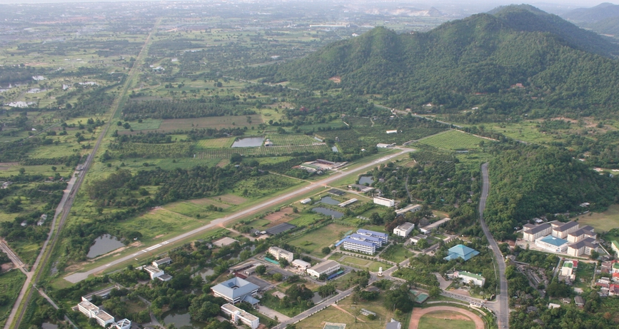